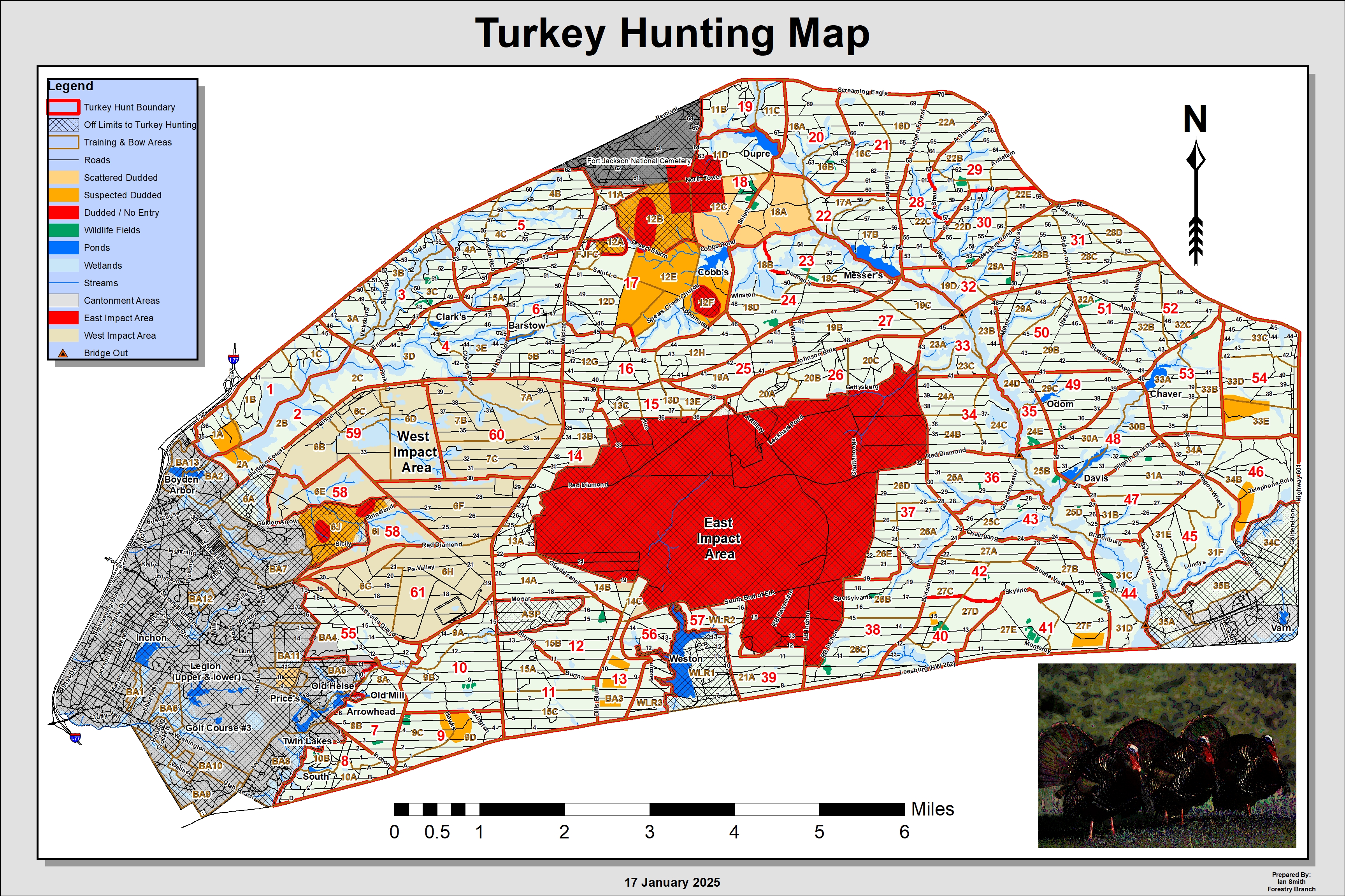
Reference maps
Click the link to download the associated map
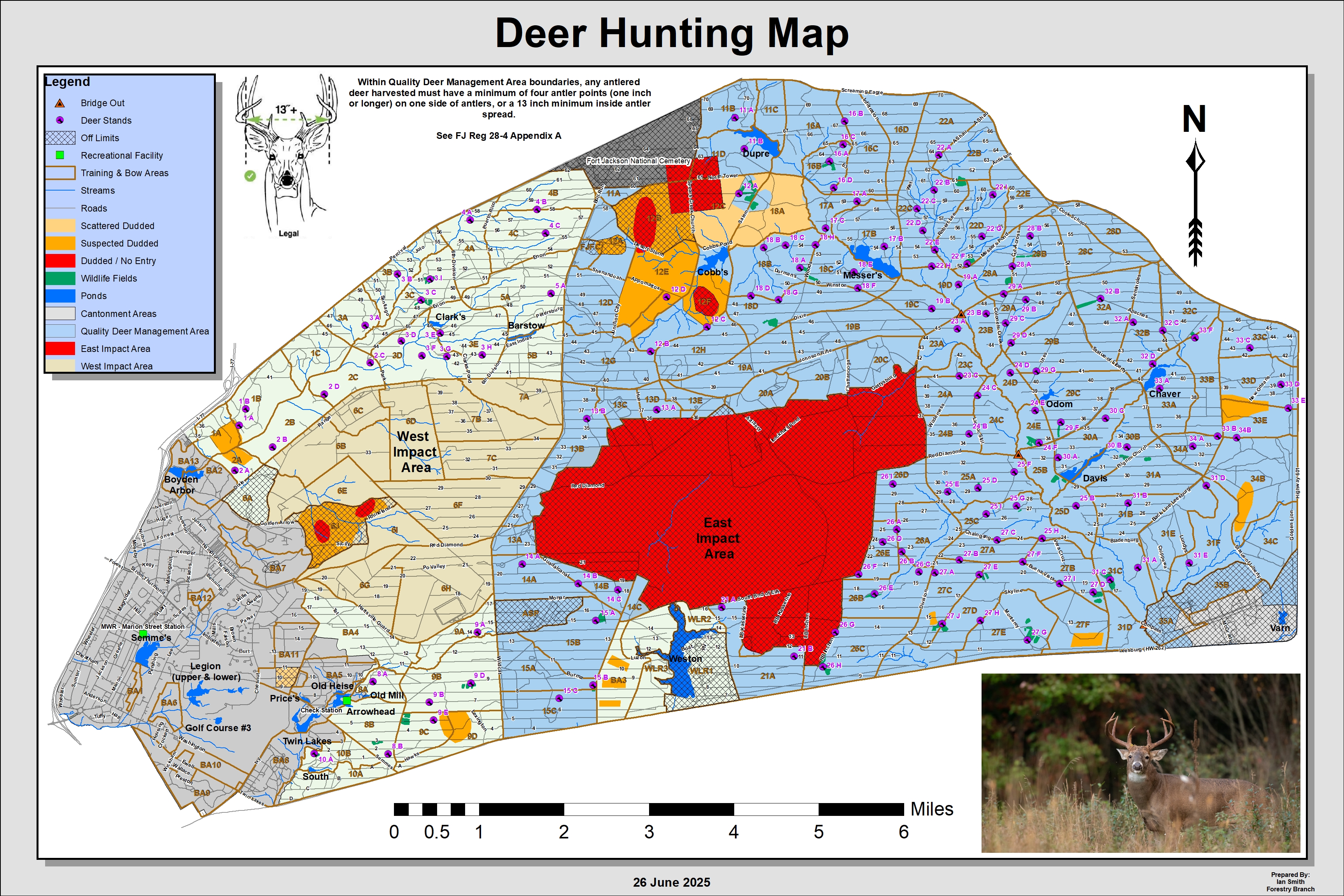
Training Area and Deer Stand Map

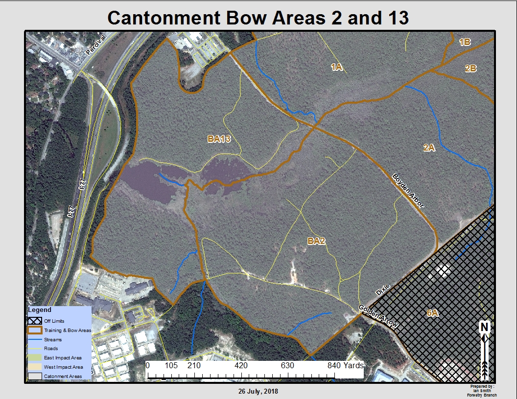
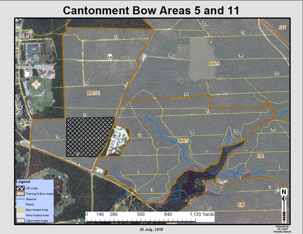
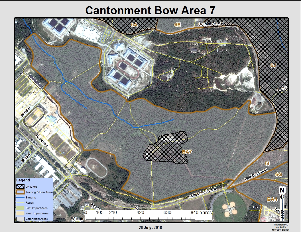
Bow Areas 1 and 6 Bow Areas 2 and 13 Bow Areas 5 and 11 Bow Area 7
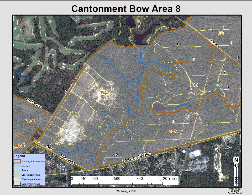
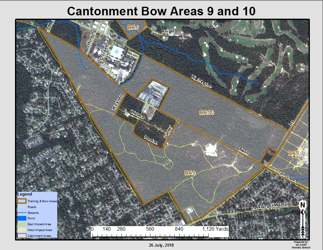
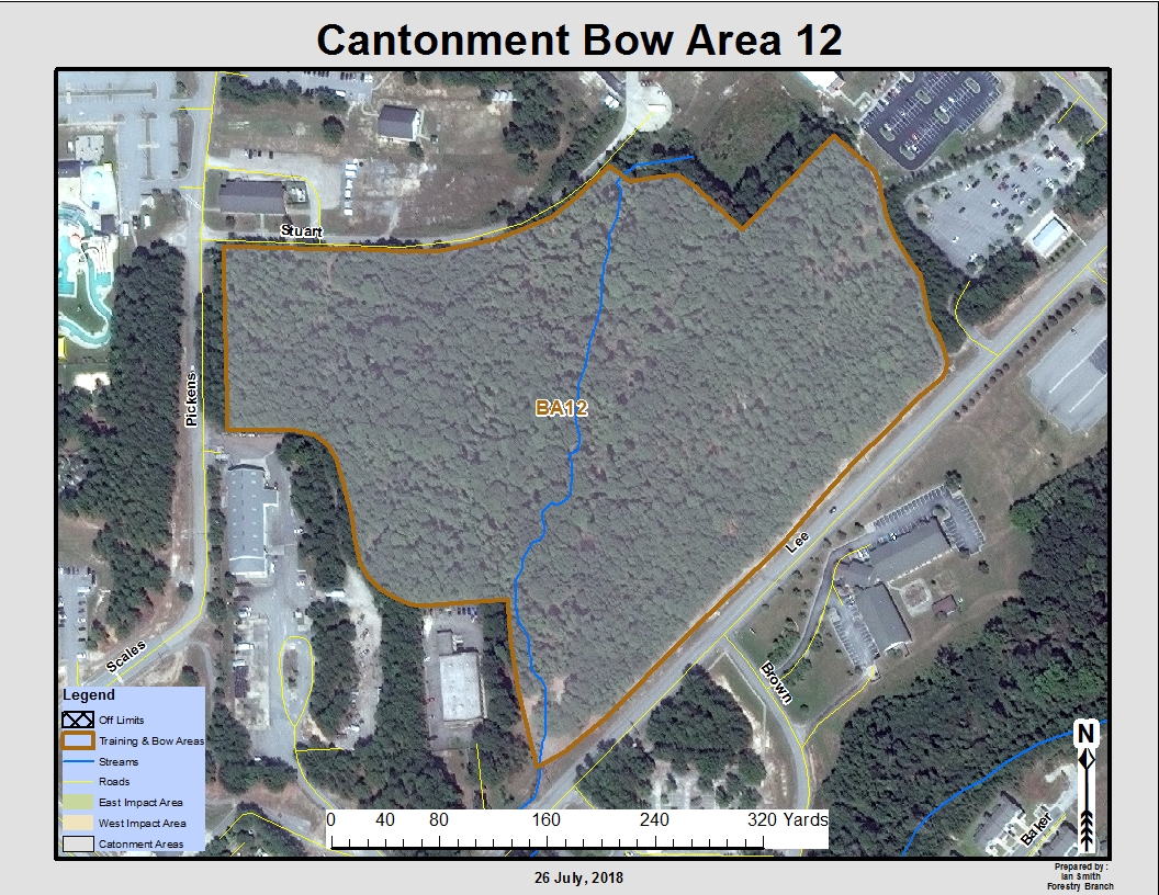
Bow Area 8 Bow Areas 9 and 10 Bow Area 12
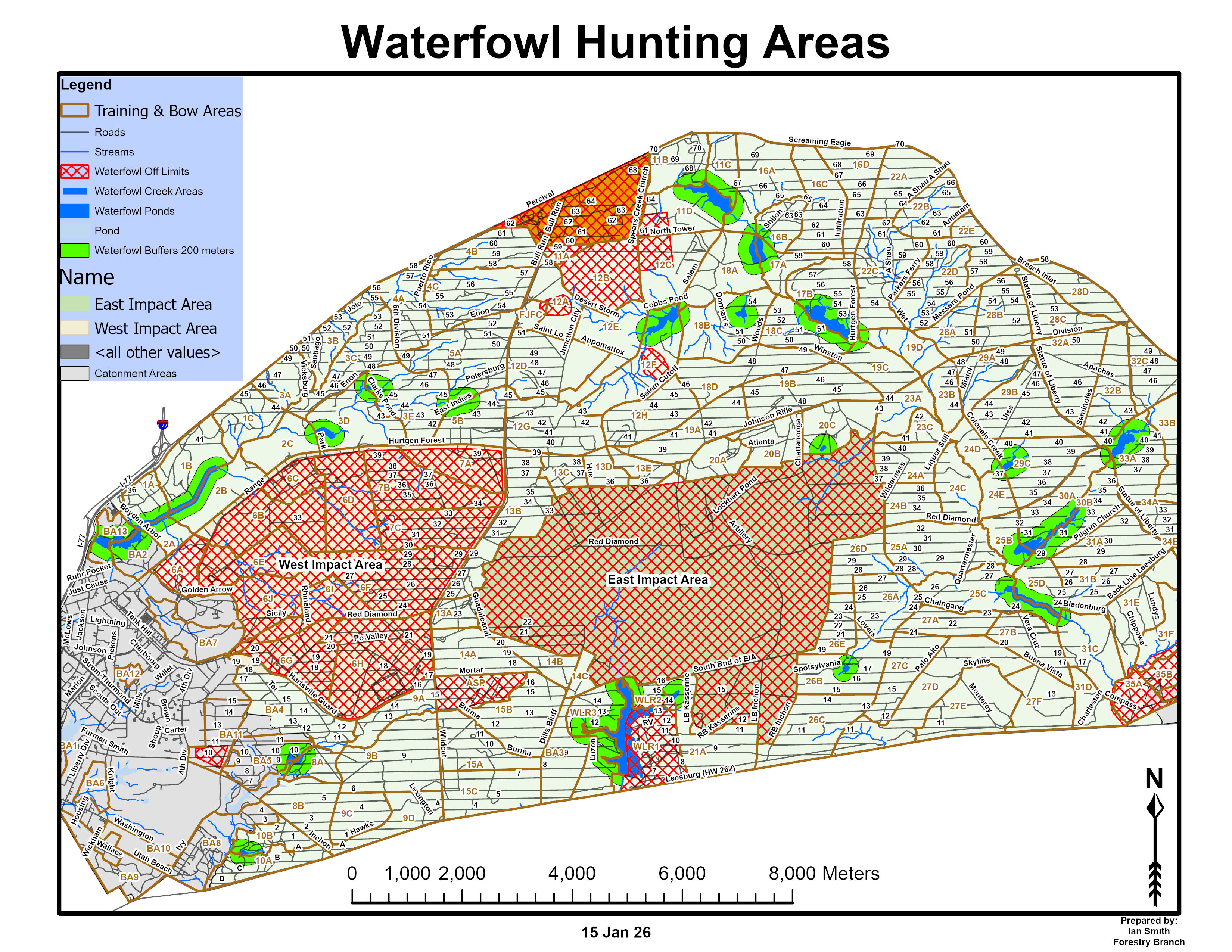
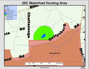
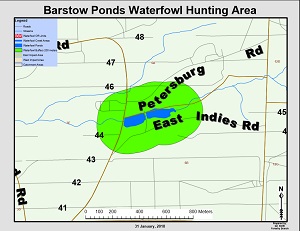
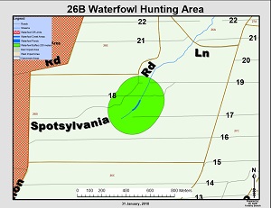
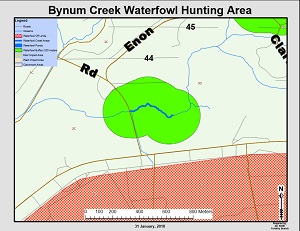
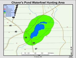
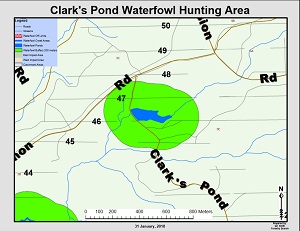
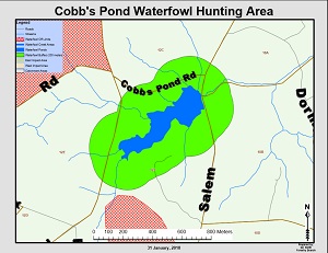
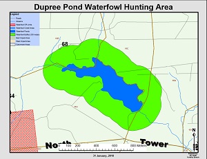
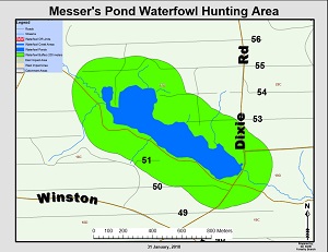
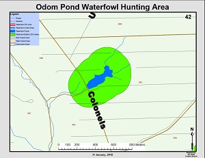
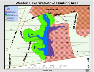
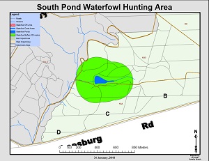
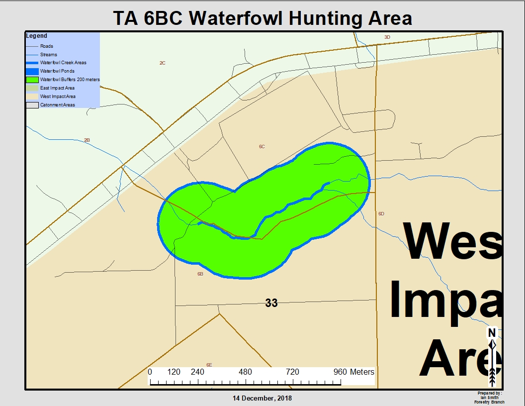
Waterfowl Hunting Areas Overall
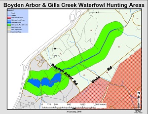
Boyden Arbor and Gills Creek Waterfowl Areas

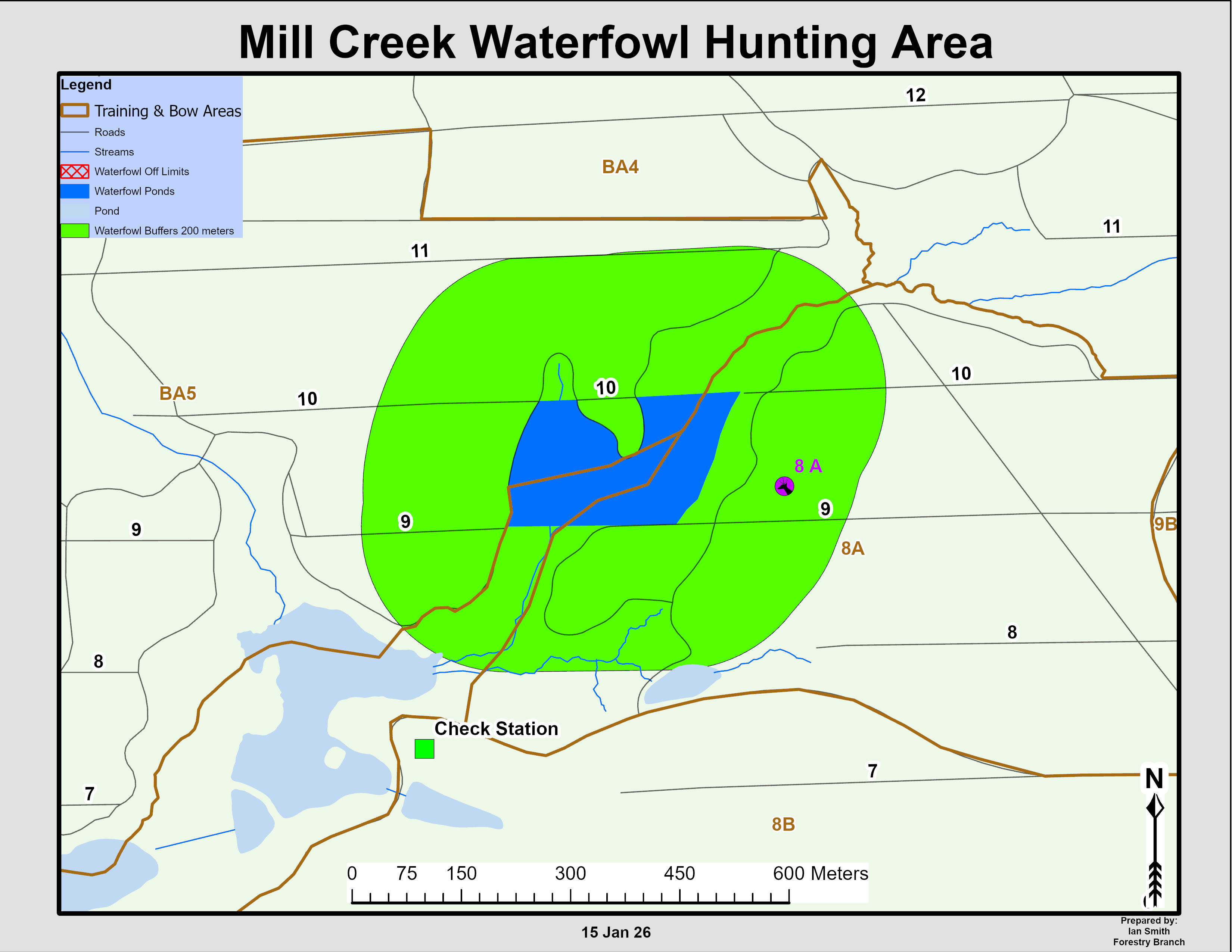
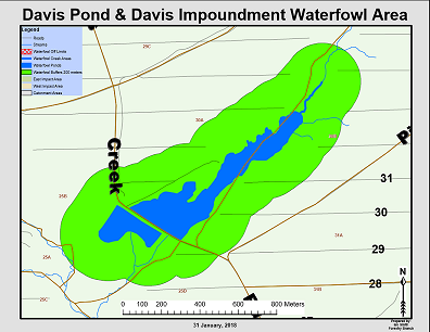
Mill Creek Waterfowl Hunting Area
NOTE: When Deer and Waterfowl seasons coincide, a 200-meter buffer exists around waterfowl hunt areas open to waterfowl hunting. Deer hunting is prohibited within this buffer during the hours of waterfowl hunting on days when these areas are open to waterfowl hunters.
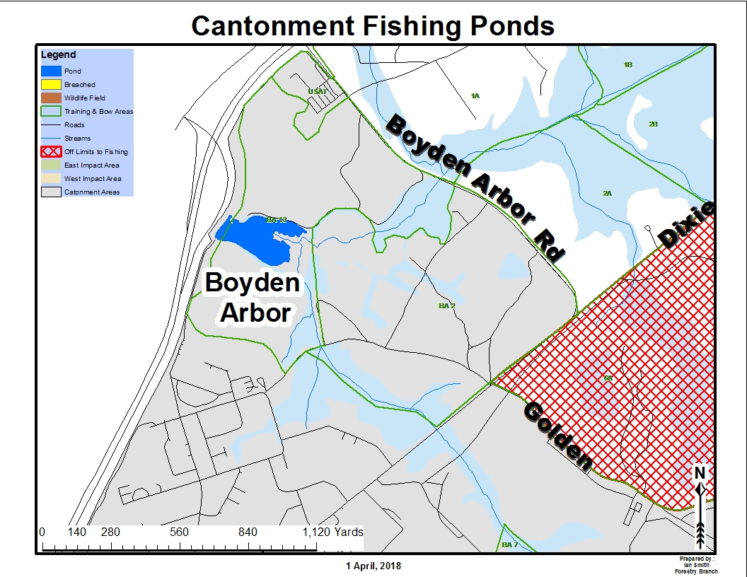
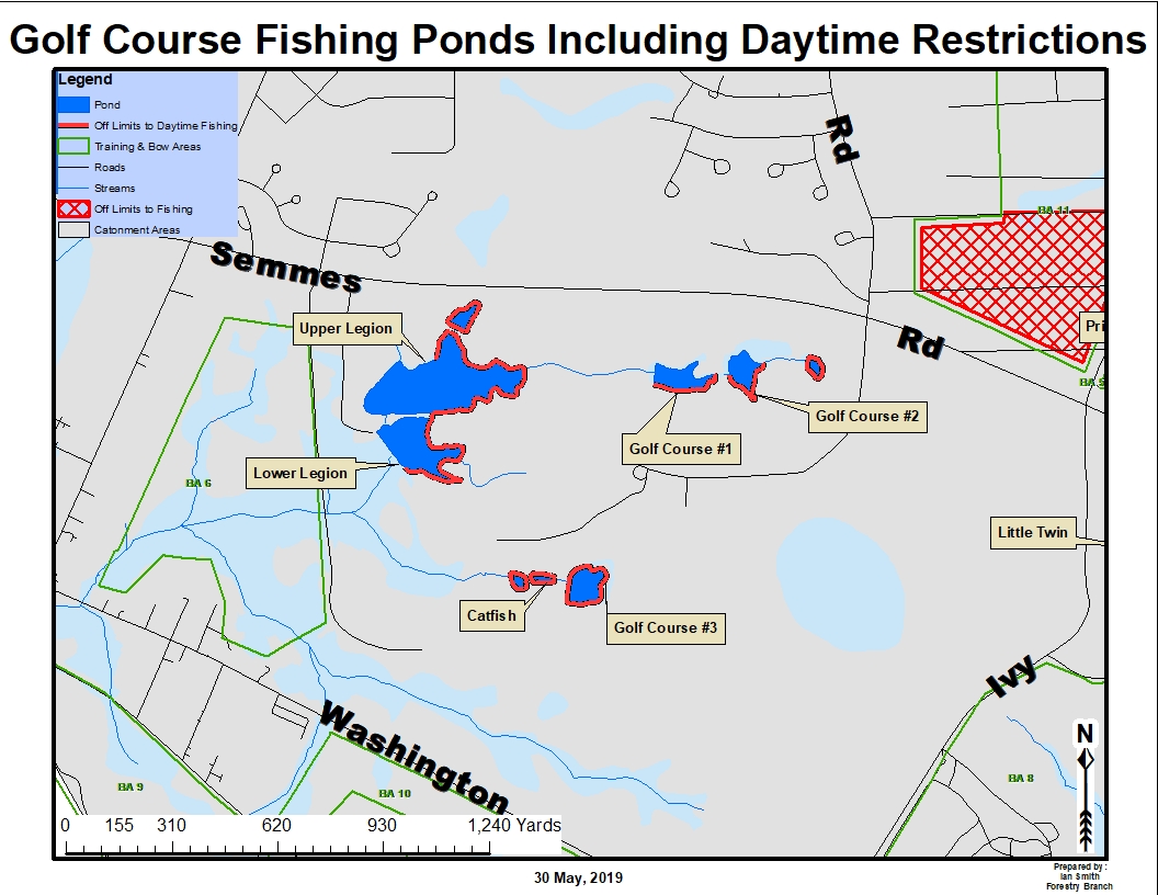
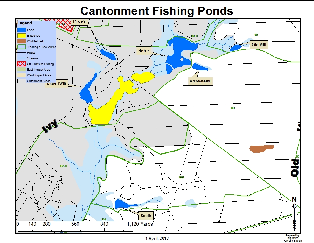
Boyden Arbor Pond Golf Course Area Ponds
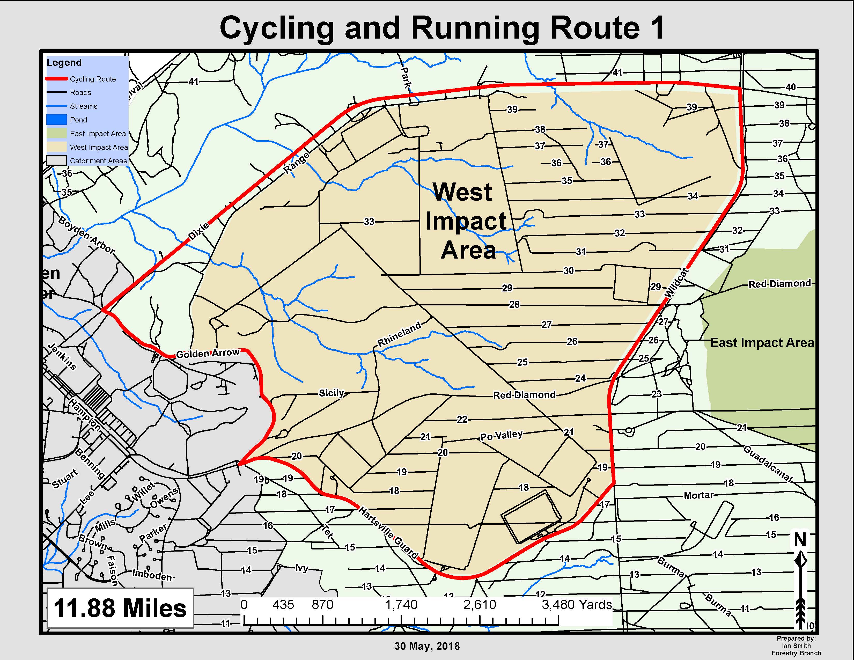
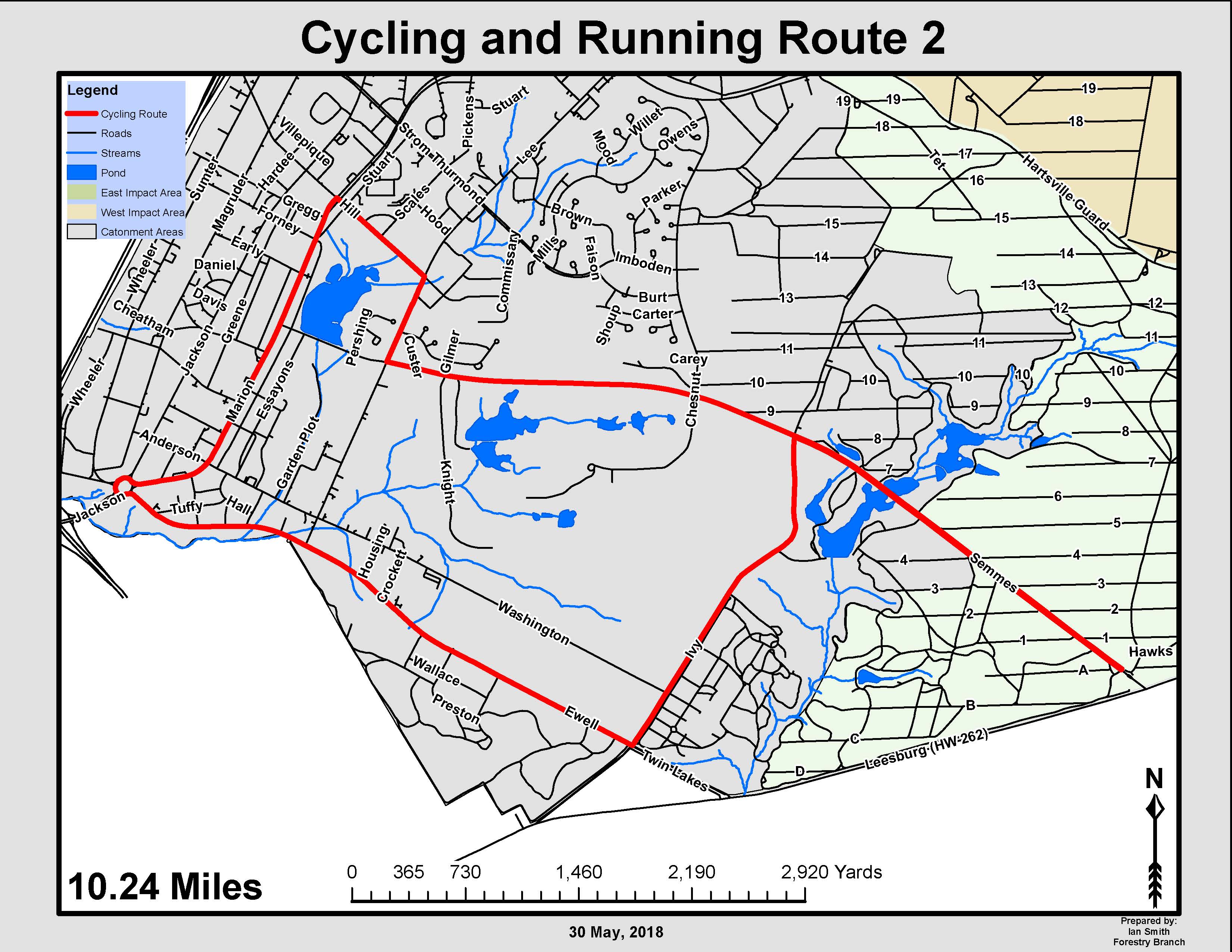
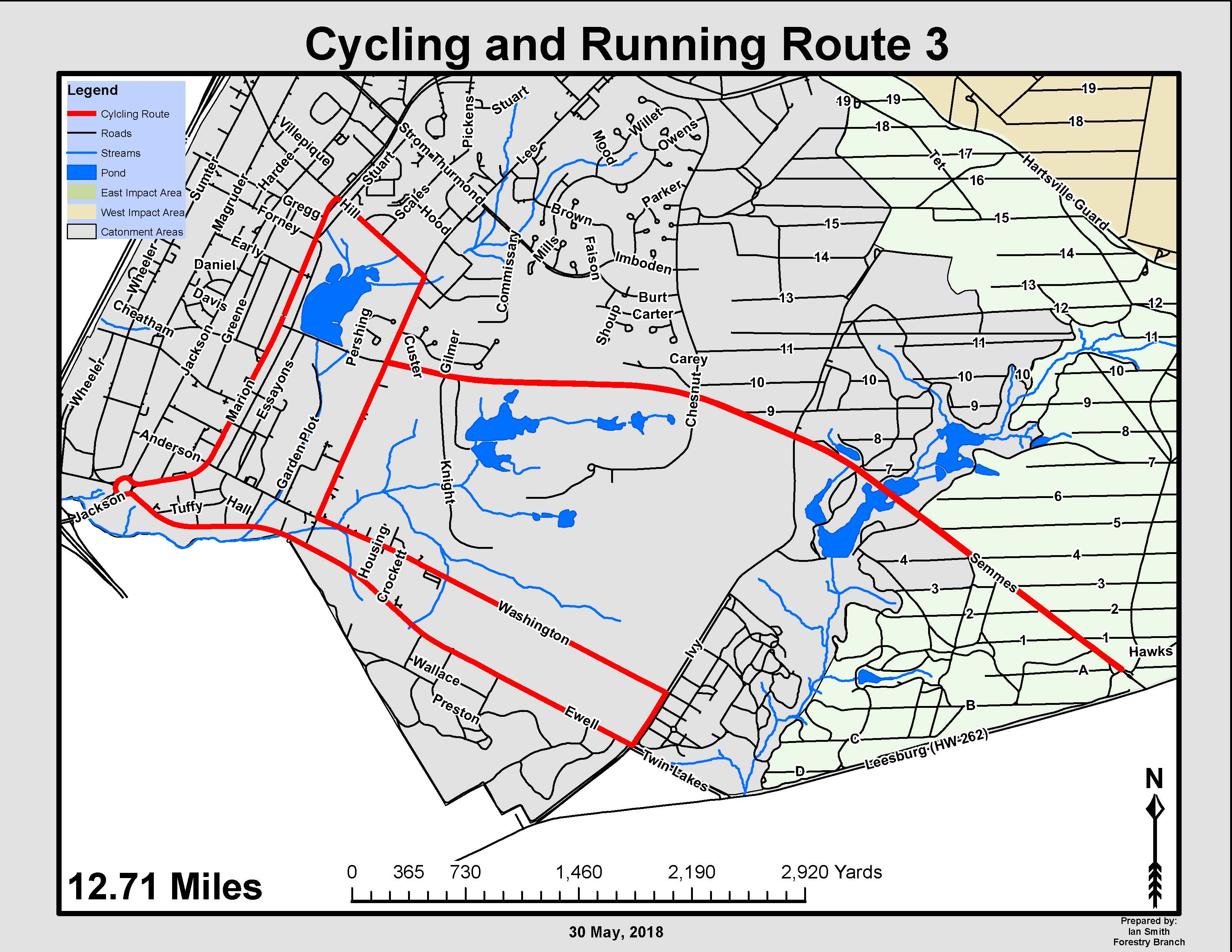
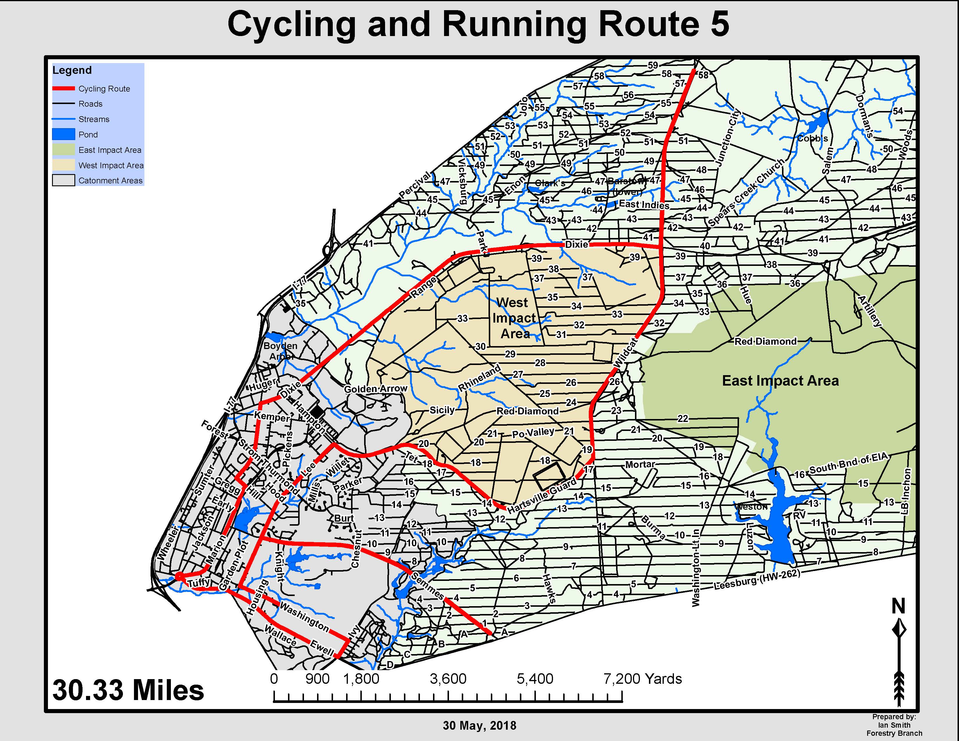
Range Area Cycling Routes